Public + Private Fish Plants The Freshest
The Freshest
Fish Plant Updates
Free daily fish plant alerts and a live map to see what's been planted near you. No other platform tracks both.
Already have an account? Log in
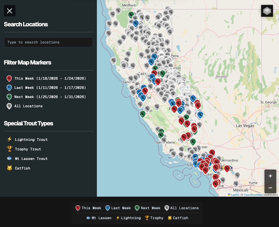
850 Spots
Daily Updates
328 Pro Spots
Just Planted
The Latest Fish Plants
Fresh from public and private waters across California, updated daily.
Just Added Lake Poway San Diego County 2000lbs. catfish This Week Cucamonga Guasti Park Lake San Bernardino County 605lbs. catfish This Week Glen Helen Park Lake San Bernardino County 605lbs. catfish This Week Mojave Narrows Regional Park Lake San Bernardino County 605lbs. catfish This Week Prado Park Lake San Bernardino County 605lbs. catfish This Week Yucaipa Lake San Bernardino County 605lbs. catfish This Week Mountain Lakes San Bernardino County 500lbs. catfish This Week Lake Jennings San Diego County 1000lbs. catfish This Week Convict Creek Mono County 500lbs. trout This Week Rock Creek (Section 2) Mono County 500lbs. trout This Week Rock Creek (Section 1) Mono County 500lbs. trout This Week Owens River (Section 2) Inyo County 500lbs. trout
New Maps Weekly
Pro Maps
Get a head start with 328 scouted spots across 14 maps. Unlock them all with any shop purchase.
✨ JUST ADDED 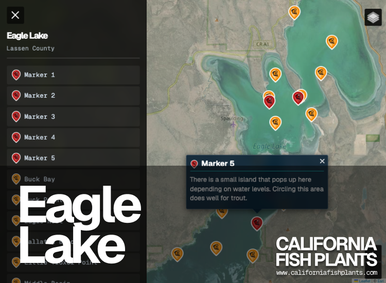
 5 Pro Marker
  17 Reference Point
  1 Shop
  1 Tent Camping View Map → 🔥 UPDATED
 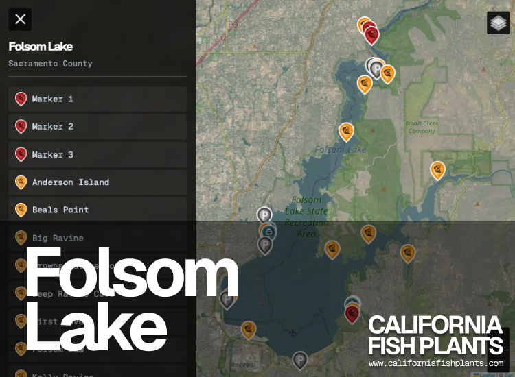 3 Pro Marker 13 Reference Point
  4 Boat Launch
  8 Parking
  1 Restroom View Map →
 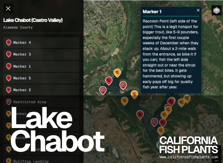 5 Pro Marker 17 Reference Point 1 Boat Launch 1 Parking 1 Shop
  3 Restricted 1 Tent Camping 1 Restroom View Map →
 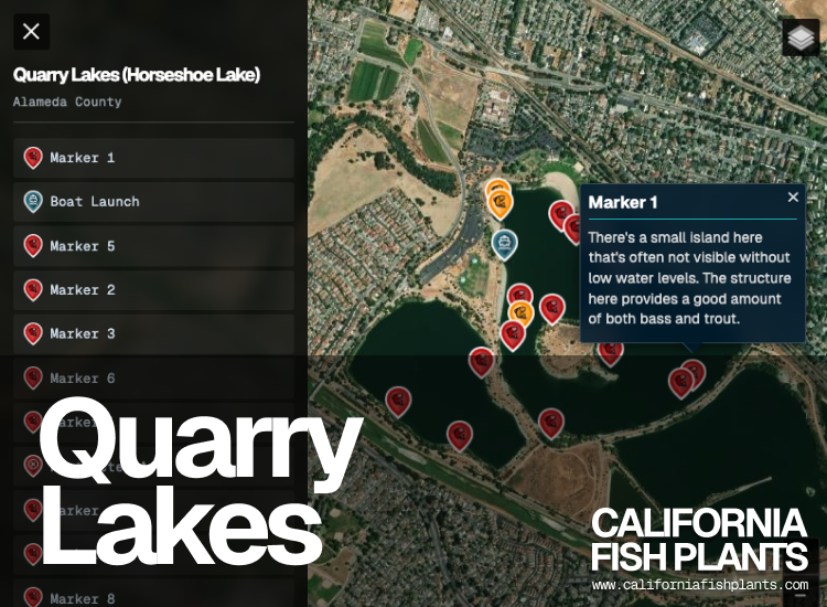 12 Pro Marker 3 Reference Point 1 Boat Launch 1 Restricted
  1 Gate/Entrance View Map →
 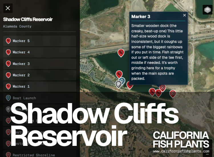 5 Pro Marker 5 Reference Point 1 Boat Launch 1 Parking 4 Restricted View Map →
 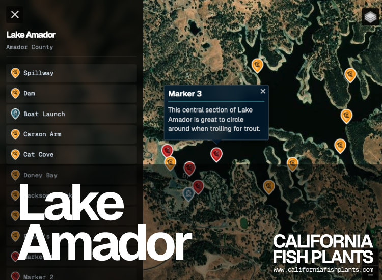 9 Pro Marker 9 Reference Point 1 Boat Launch 1 Restricted 3 Tent Camping View Map →
 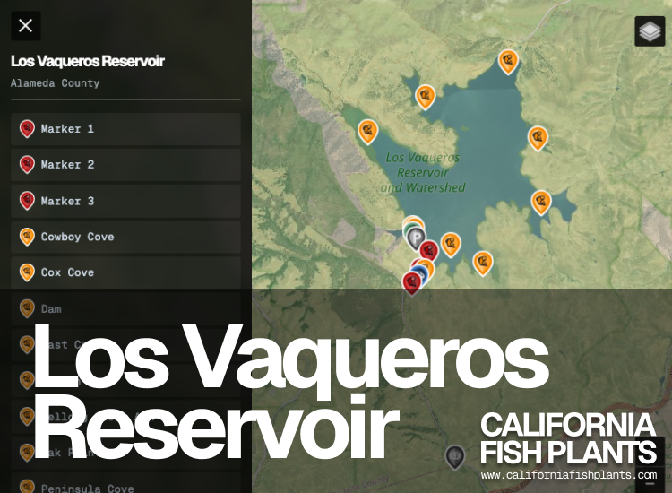 5 Pro Marker 10 Reference Point
  1 Plant Dropoff 1 Parking 1 Shop 1 Gate/Entrance View Map →
 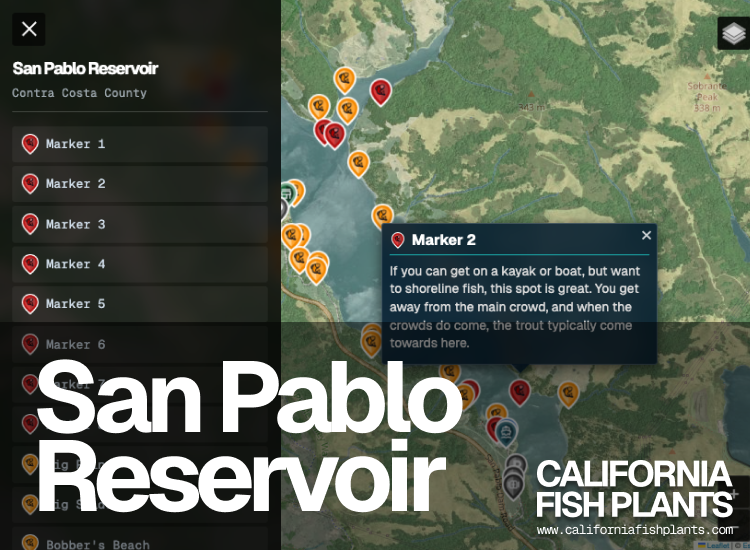 8 Pro Marker 26 Reference Point 1 Plant Dropoff 1 Boat Launch 4 Parking 1 Shop 1 Gate/Entrance View Map →
 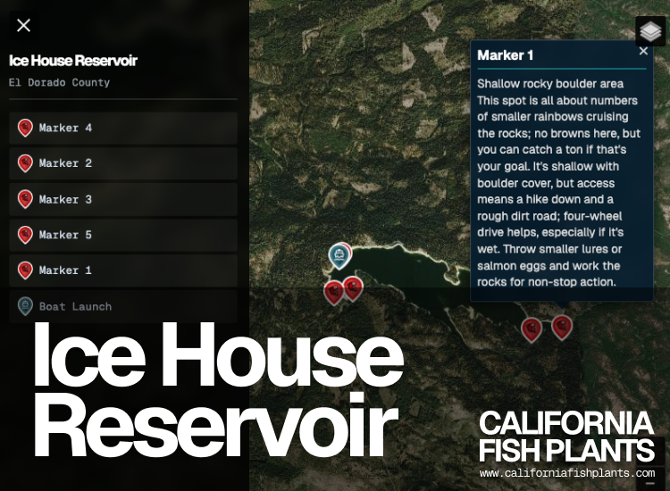 5 Pro Marker 1 Reference Point 1 Boat Launch 5 Tent Camping View Map →
 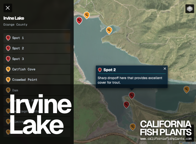 3 Pro Marker 7 Reference Point View Map →
Eagle Lake
5 Pro Marker 17 Reference Point 1 Shop 1 Tent Camping Folsom Lake
3 Pro Marker 13 Reference Point 4 Boat Launch 8 Parking 1 Restroom Lake Chabot (Castro Valley)
5 Pro Marker 17 Reference Point 1 Boat Launch 1 Parking 1 Shop 3 Restricted 1 Tent Camping 1 Restroom Quarry Lakes (Horseshoe Lake)
12 Pro Marker 3 Reference Point 1 Boat Launch 1 Restricted 1 Gate/Entrance Shadow Cliffs Reservoir
5 Pro Marker 5 Reference Point 1 Boat Launch 1 Parking 4 Restricted Lake Amador
9 Pro Marker 9 Reference Point 1 Boat Launch 1 Restricted 3 Tent Camping Los Vaqueros Reservoir
5 Pro Marker 10 Reference Point 1 Plant Dropoff 1 Parking 1 Shop 1 Gate/Entrance San Pablo Reservoir
8 Pro Marker 26 Reference Point 1 Plant Dropoff 1 Boat Launch 4 Parking 1 Shop 1 Gate/Entrance Ice House Reservoir
5 Pro Marker 1 Reference Point 1 Boat Launch 5 Tent Camping Irvine Lake
3 Pro Marker 7 Reference Point California Tackle
What Anglers Are Buying
California-made tackle that's actually working.
🎣 TOP PICK
🚫 SOLD OUT

⚡ ALMOST GONE
🔥 BEST SELLER
From the Field
Gear That Works
Tested in California waters by local anglers.
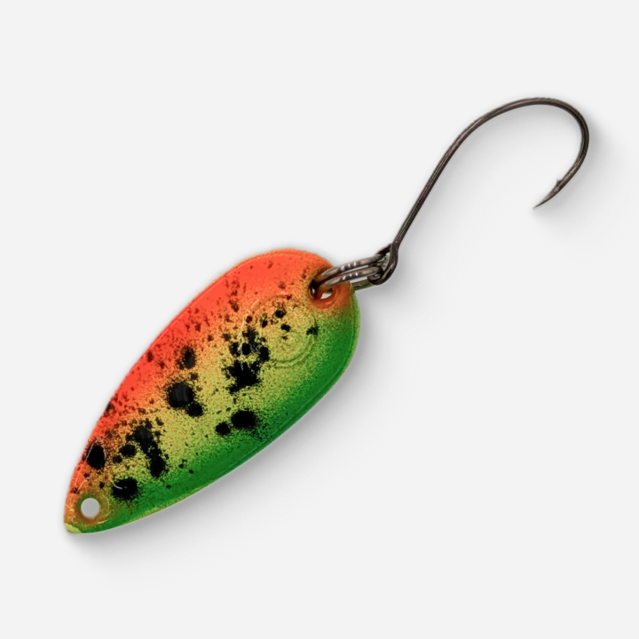
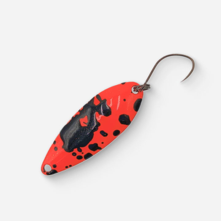
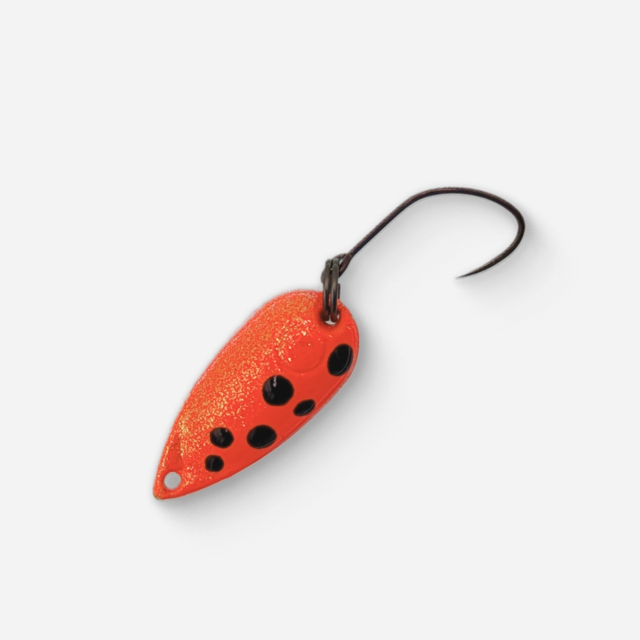
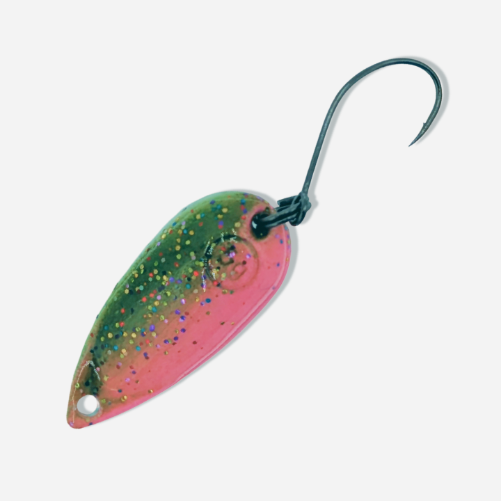
Trout Candy Spoons
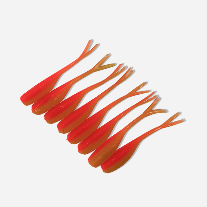
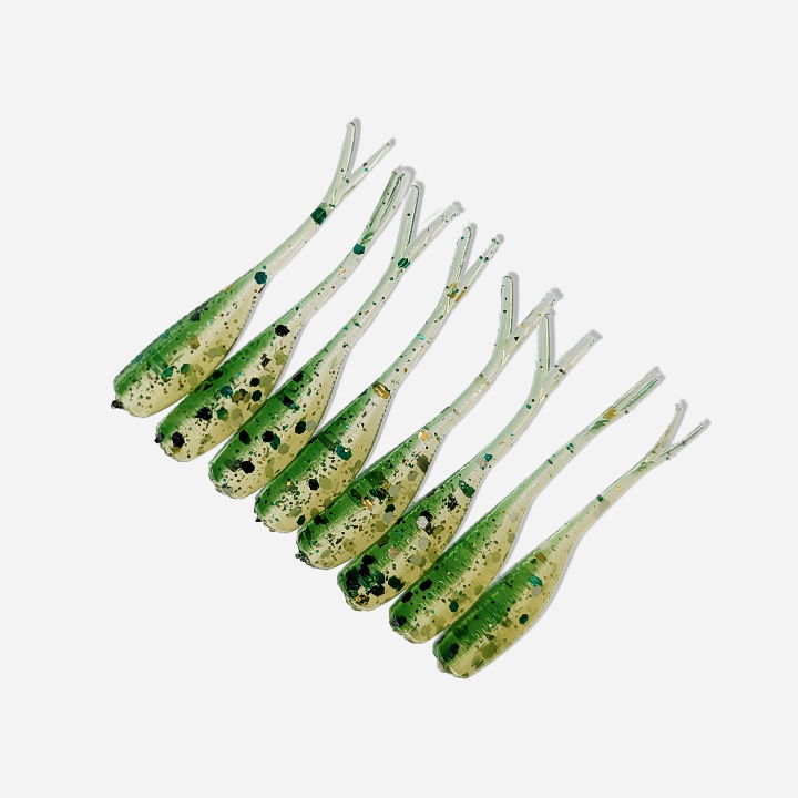
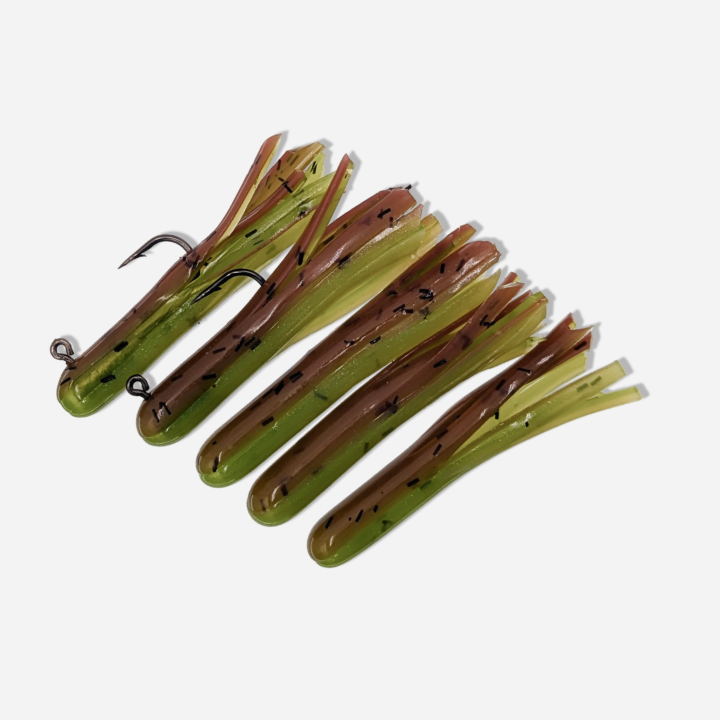
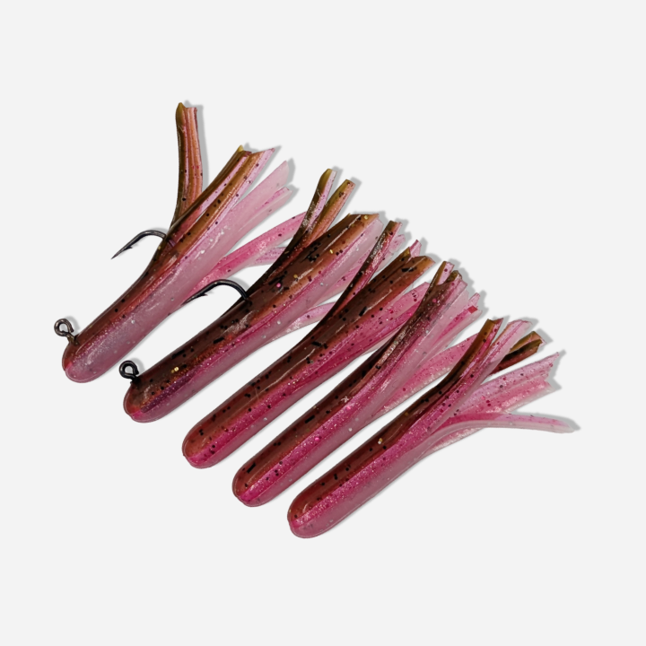
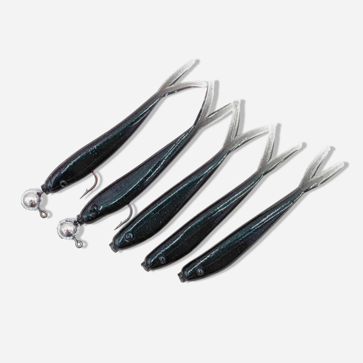
Fish Thug Baits
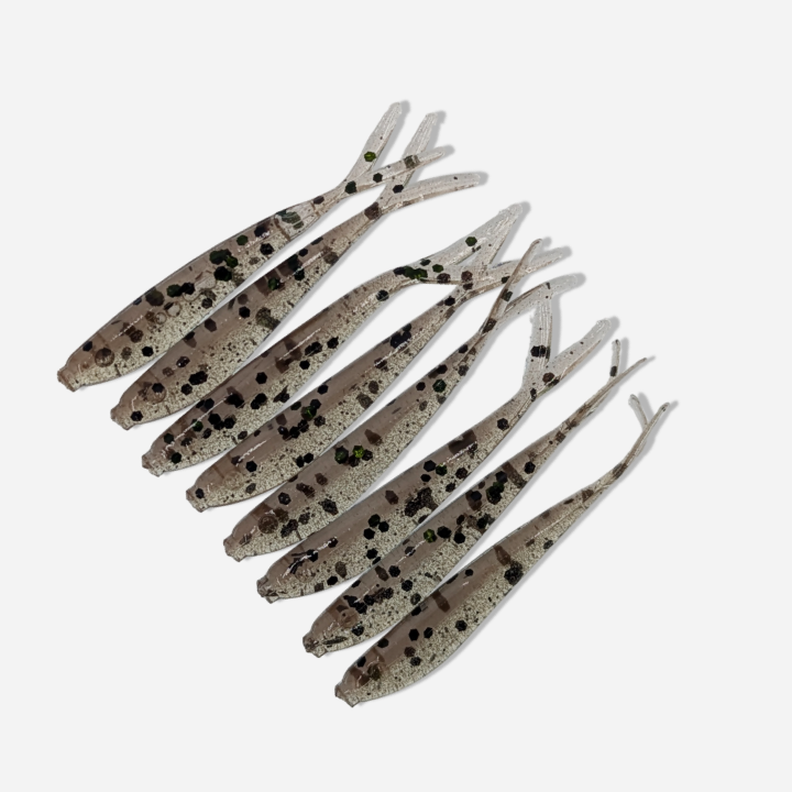
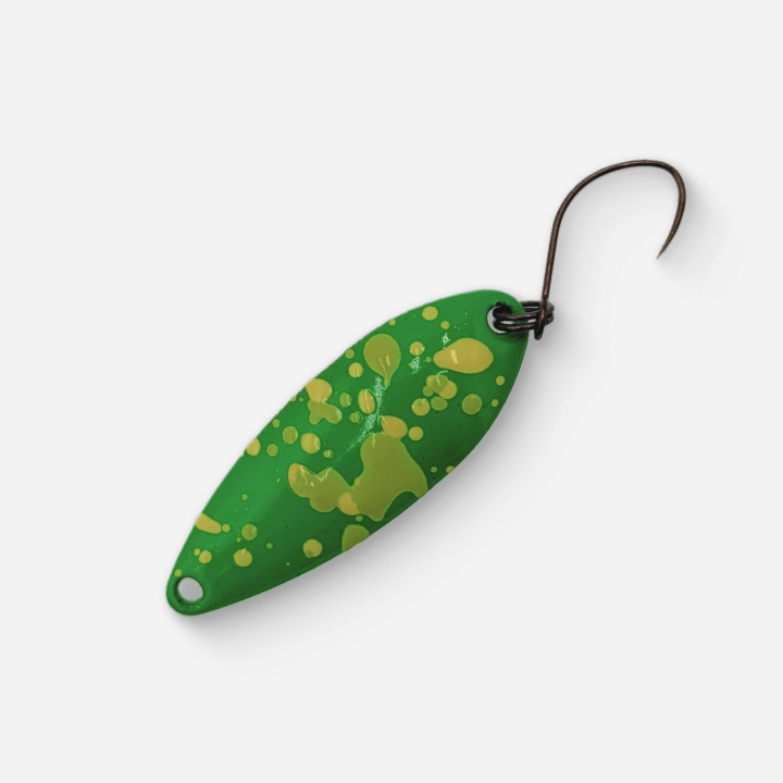
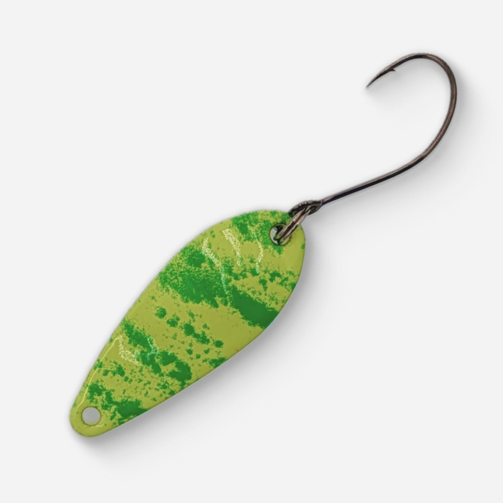
MADE Baits
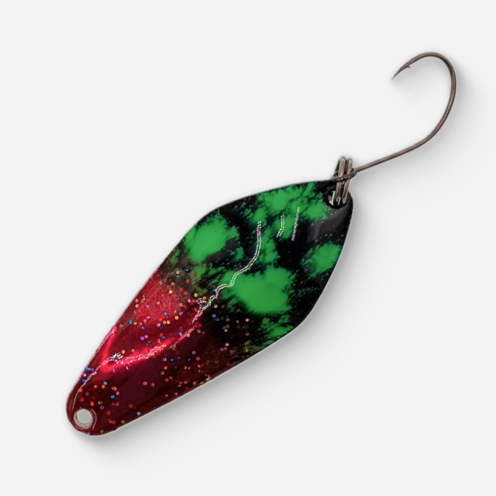
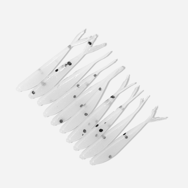
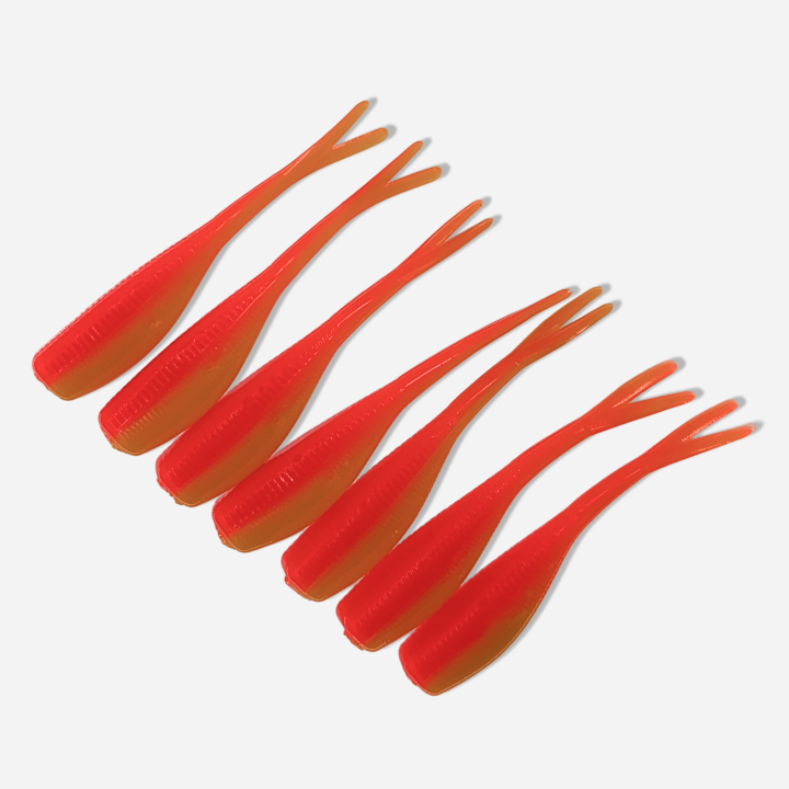
Dancin Fish Baits
Free Daily Alerts
Know Before the Fish Do
Freshly planted trout get caught out fast. Get free daily fish plant alerts and hit the water while the bite is hot, not a week late.